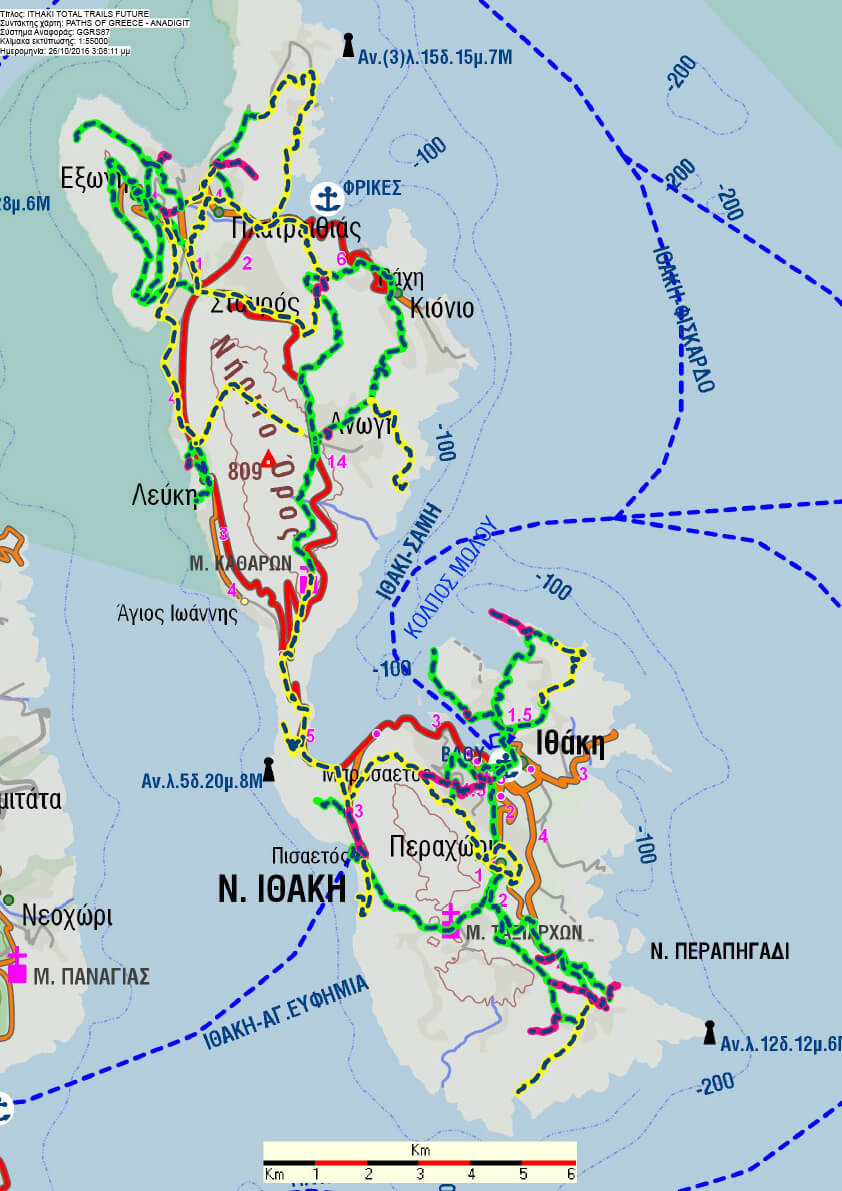
The mountainous relief of Ithaca with the formation of small inland plateaus at Anogi on Mt Niritos (809 m) and Marathias, is framed by windswept capes, islets, bays and beaches. The Eastern coast lowers smoothly, while on the steep western coastline only two bays are observed: Polis to the north and Pisaetos to the south, surrounded by inaccessible small sandy beaches at the base of steep cliffs. In Ithaca, trails are related with history and Venetian rule, when pirates were defeated and the trails served to the inhabitants of Exogi, Anogi and abundoned medieval Paleochora to move from these remote areas and settle closer to the coast at Stavros and Platreithias, Kioni, Perachori and Vathi respectively. Other paths lead to windmills on top of well-ventilated hills with a panoramic view, such as the mill at Panagia at Skala which is connected to Frikes picturesque harbour. Trails may connect Geosites p.es. Vathi with Skinos and Gidaki or the cave of the Nymphs and lead to beaches by passing through a pine forest (Exogi), vegetable gardens (Αfales bay), or freshwater sources (Arethousa Κrini). They may also lead to cultural and/or religious destinations, p.es. from Agios (Saint) Georgios chapel a trail leads to the Acropolis of Alalkomenes, from Anogi to the Holy Monastery of Kathara, and from Perachori to the chapel of Agia Paraskevi by crossing a forest of perennial evergreen oak trees. Trails are also related to tradition; on the feast day of Panagia Spilaiotissa (meaning the Virgin Mary of the cave) the 2nd of July, the cave-church is reached by crossing Marathias plateau following a trail from Perachori or Vathi, which may also be the starting points of a trail leading the Holy Monastery of Taxiarches celebrating the 13th of July.
https://www.ithaca.gr/archiki/endiaferonta-ke-drastiriotites/monopatia/