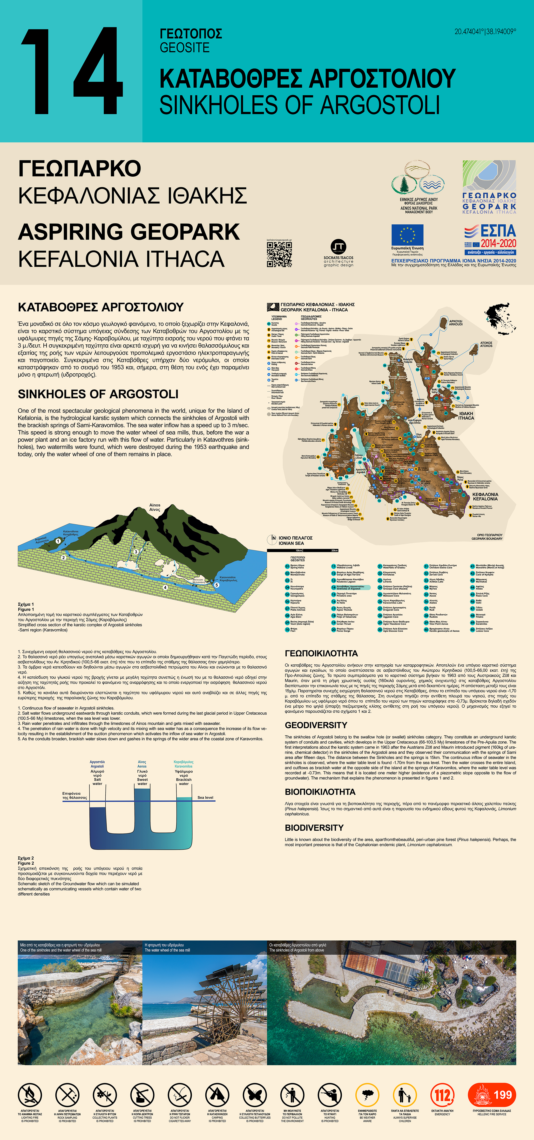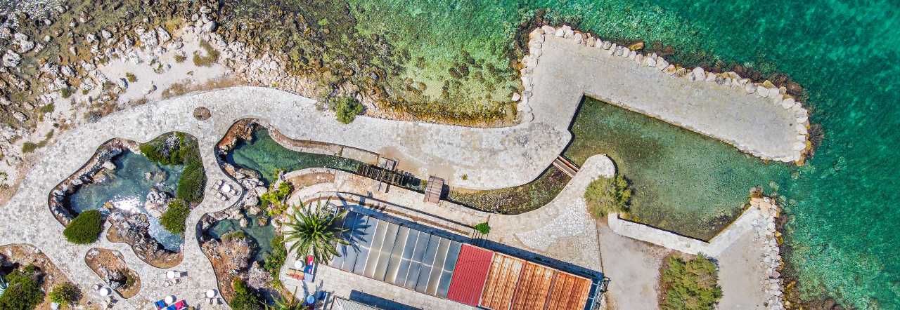
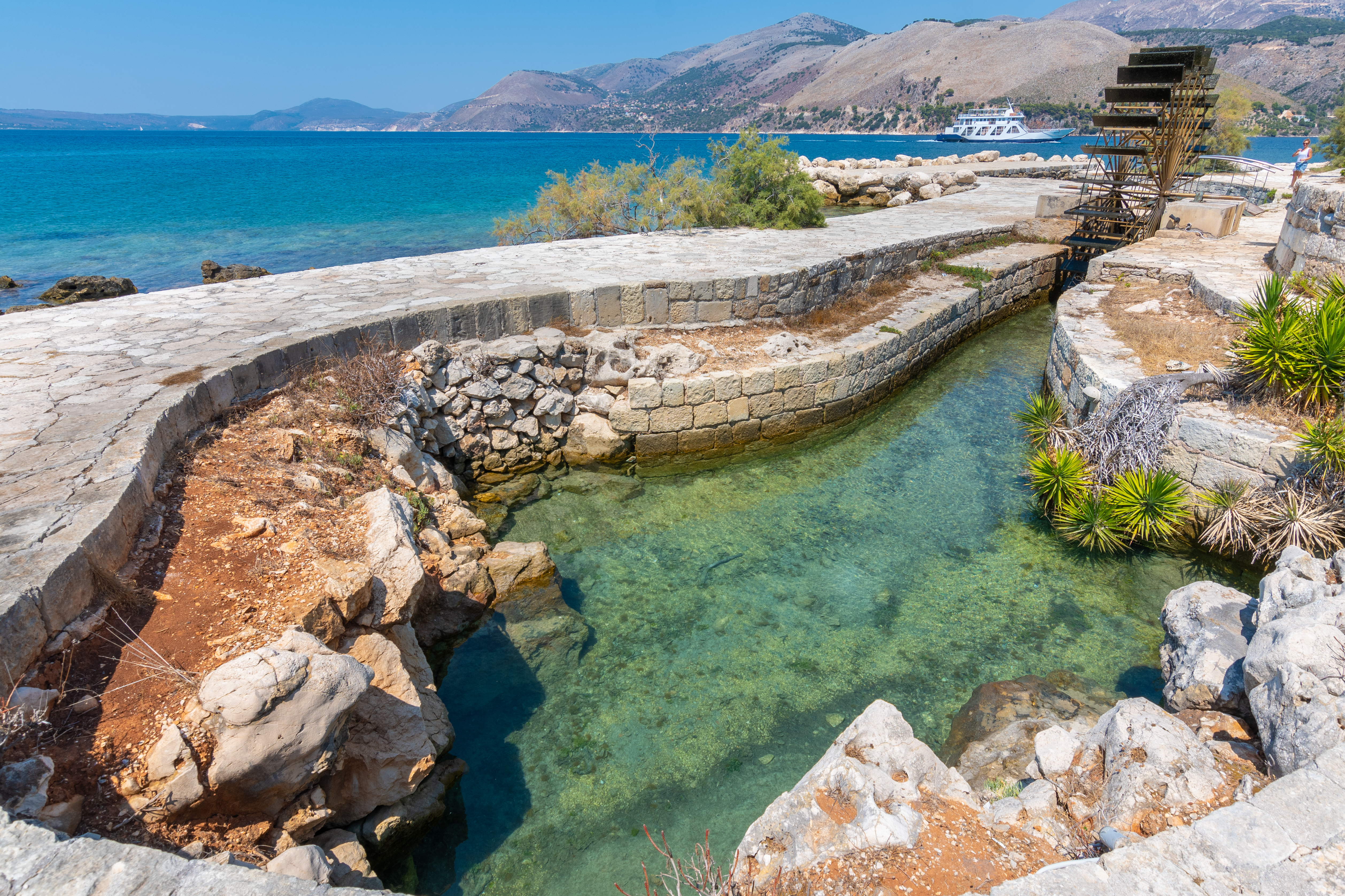
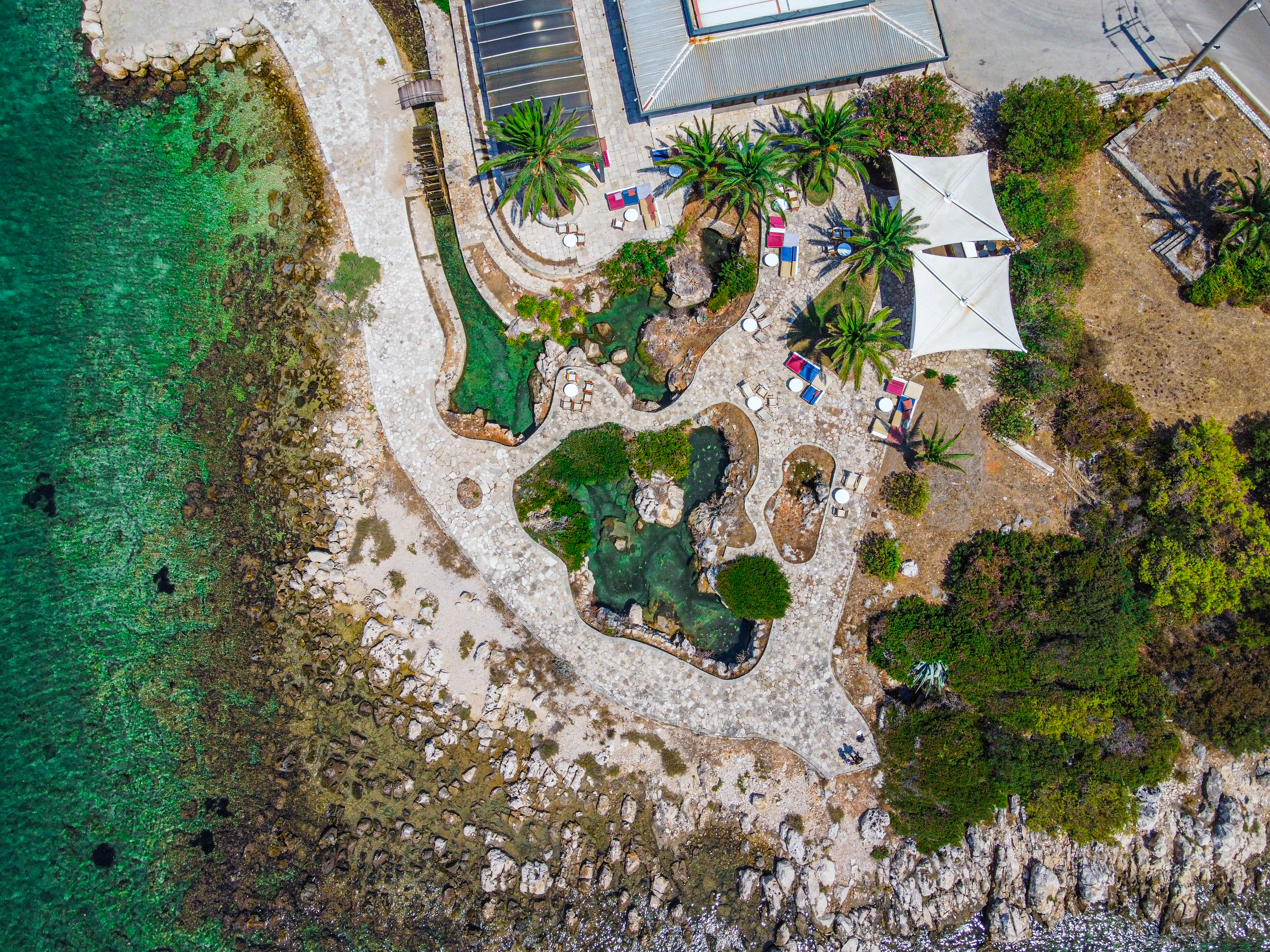
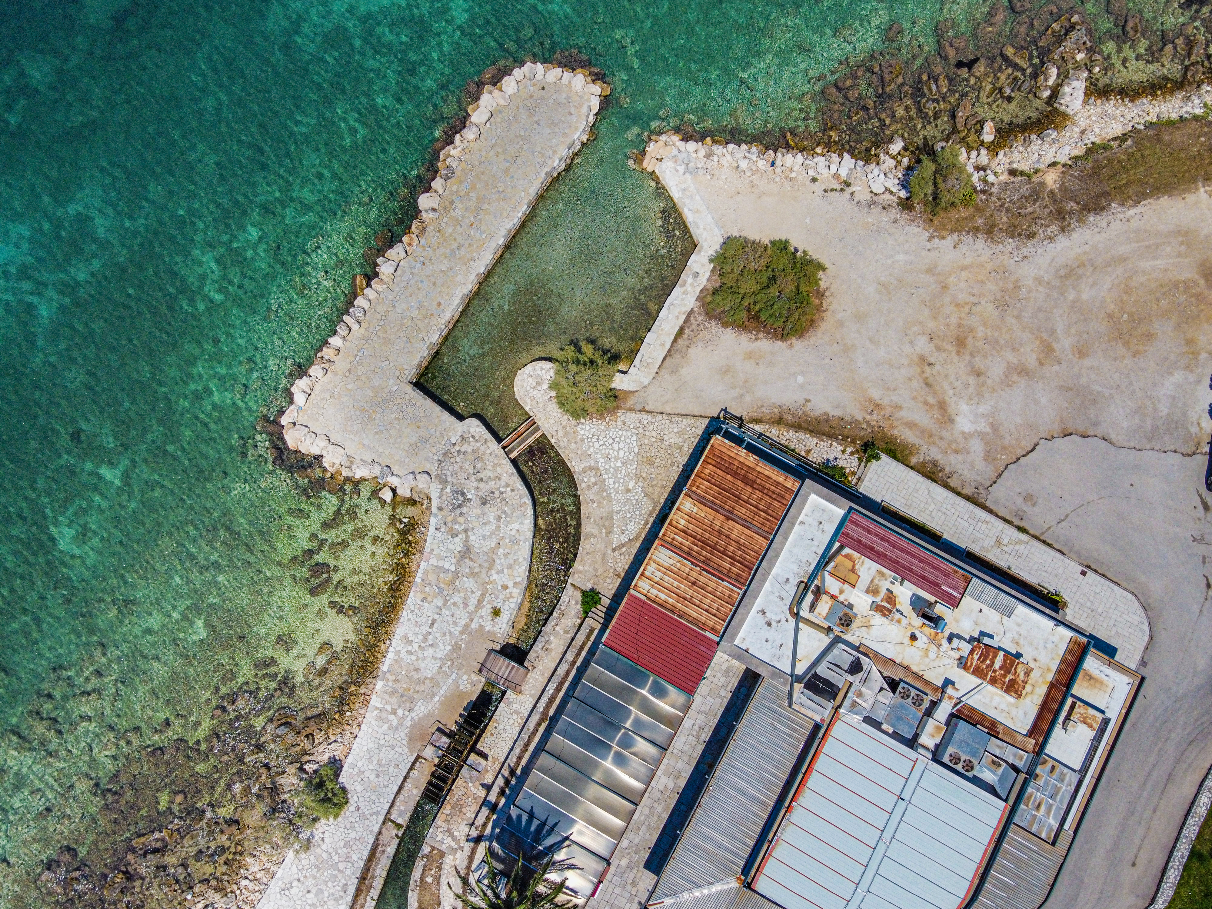
In the island of Kefalonia occurs one of the most astonishing geological phenomena worldwide which is based on a hydrological karst system that connects the Sinkholes of Argostoli with the brackish spring of Karavomilos, Sami. Sea-water flowing into the Sinkholes with a speed of 3 m/sec was used in the past to rotate the water wheel of sea mills (Figure 1) and provide power supply for the operation of a power plant and an ice factory running until the World War II.
These two watermills at Katavothres (sinkholes) were destroyed during the 1953 earthquake and today only the water wheel of one of them remains in place. The first mill was built by the Englishman Stevens in 1835, when he observed the extraordinary hydrogeological phenomenon of the area and decided to exploit it commercially. The second watermill was built by Miliaressis in 1857, who later bought the older Stevens’ mill, while during 1917- 1922 both watermills were owned by Angelos Trombetas, grinding wheat and barley for beer- brewing.
Geodiversity
The sinkholes of Argostoli are located near the "Agioi Theodoroi" promontory in the wider area of Lassi - Argostoli and they belong to the swallow hole (or swallet) sinkholes category. They constitute an underground karstic system of conduits and cavities, which develops in the Upper Cretaceous (100.5-66.0 My) limestones of the Pre-Apulia zone (Figure 2).
Similar karstic phenomena have been also observed in other places around the world, nevertheless, the hydrogeological mechanism that controls the karstic system of Kephalonia sinkholes cannot be found anywhere else, thus, this phenomenon can definitely be considered as one of the most spectacular and interesting hydrogeological phenomena in the world and which preoccupied geoscientists for about 150 years. These data are 1) the steady inflow of seawater in the sinkholes, which crosses the entire island, and outflows as brackish water in the opposite side of the island at the springs of Karavomilos, 2) the significant flow rate of seawater in the sinkholes which has been measured up to 3m / sec, and 3) the fluctuation of the suction speed, depending on the amount of atmospheric precipitation (Figure 3).
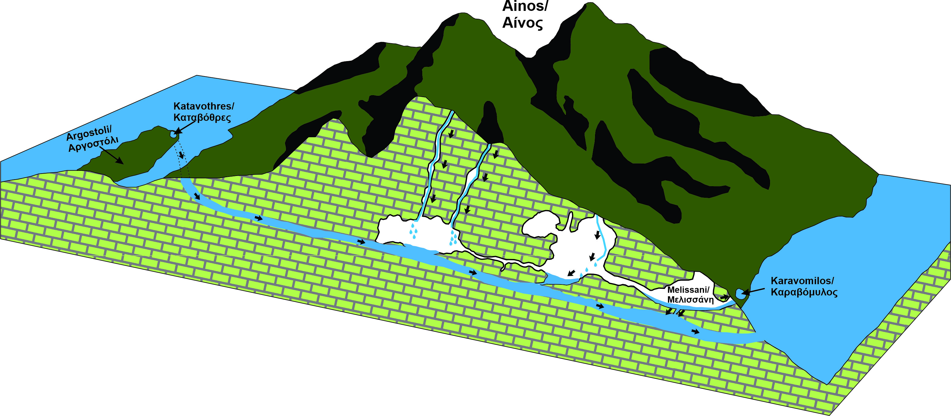
The first conclusions about the karstic complex of Argostoli - Sami region sinkholes came in 1963 from after the Austrians Zötl and Maurin introduced pigment (160Kgr of uranine, chemical detector) in the sinkholes of the Argostoli area and they observed their communication with the springs of Sami area after fifteen days. The distance between the Sinkholes and the springs in a straight line is 15km (Figure 4).
Many hypotheses have been made to explain this phenomenon through various mechanisms. The most common of which is the theory of ocean tides and strong winds that have been used to explain similar phenomena, but cannot be applied to the island, due to the uninterrupted inflow of water. It is therefore not possible to interpret the cause of the phenomenon in periodic floods or winds, as they do not provide a constant force and direction.
According to studies that have been carried out on the phenomenon, the following factors seem to contribute:
- The sea level on the side of the sinkholes is higher than the discharge springs in the area of Sami. This fact is due to the energy of the Aegean-Adriatic current and is the initial cause of the phenomenon. It should be noted that the phenomenon of altitude difference in sea level does not always apply, but is interrupted for a few hours of the day. Thus, while the hydraulic slope described is a cause of the flow effect, it is nevertheless not the only reason, since the flow continues even when the altitude difference is zero. It has been also observed that the water table level in Katavothres is at -1.70m in relation to the sea level, while in the opposite side near the springs of Karavomilos, the water table level was recorded at -0.73m. This means that it is located one meter higher (existence of a piezometric slope opposite to the flow of groundwater).
- Consequently the movement of the water from Katavothres to the springs of Karavomilos would be completely extraordinary if there wasn’t difference in the density of groundwater. Therefore, seawater (higher density) enters through the Sinkholes, comes in contact, and mixes with the freshwater which originates from the penetration of rainwater in the carbonate rocks of Mount Aenos. Then this water which is filtered through the karstic network of the limestone rocks of Aenos, gashes as brackish water in the other side of the island, in the coastal zone of Karavomilos. Groundwater flow can be schematically simulated with communicating vessels which contain water of two different densities, as the hydrostatic equilibrium forces water to move to the side with the lowest density (Figure 5).
- Also in the existence of a karstic underground conduit network. The underground flow is realized through a permeable, karstic conduit and mainly through a large conduit (A-A1) that connects the West side of the island (Argostoli area), with the East (Sami area).The hydrographs that have been carried out in all the caves of Sami gave main axes with direction N-S, which is very close to the direction of the sinkholes which are NE-SW. From this conduit network however, only parts of it are maintained. The cause of the destruction of this karstic conduit happened due to the numerous faults that exist on the island with mainly N-S orientation. This fact explains the fortnightly delay of the pigment from Argostoli to Sami as well as the small negative altitude difference of the sinkholes compared to the springs. The creation of this karst conduit originally came from the lowering of the sea level during the Messinian (7 million years ago), which allowed the development of the coastal karstic conduit network in the area of Argostoli. Then, when a rise in sea level happened, this network became submarine, and subsequently a new withdrawal during the last ice age, which started 18,000 years ago.
- Finally, because of this conduit, the rain water from the area of Argostoli was transported to the east. "Now that the entire conduit, or parts of it, is below sea level, the hydrostatic pressure has been equalized, so the flow should have stopped. "Nevertheless, the eastern side of the island continues to be supplied through the eastern karstic network and through an additional conduit network which was created due to the penetration of rainwater in the area of Aenos. Consequently, as these two conduit networks meet , the flow velocity increases during the periods of heavy rainfall resulting in the phenomenon of suction, which activates the aspiration of seawater in Argostoli with high velocities (Bernoulli Theory).
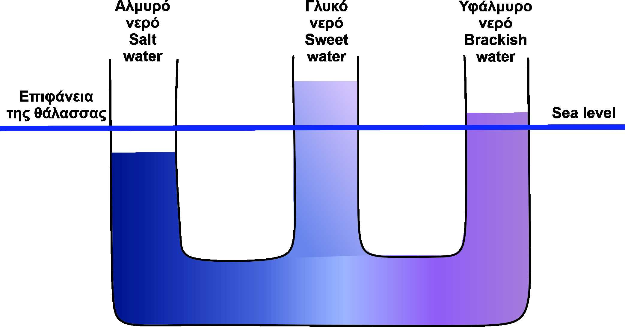
Figure 5. Schematic sketch of the Groundwater flow which can be simulated schematically as communicating vessels which contain water of two different densities
Biodiversity
Little is known about the biodiversity of the area, apart from the beautiful, peri-urban pine forest (Pinus halepensis). Perhaps, the most important presence is that of the Cephalonian endemic plant, Limonium cephalonicum.